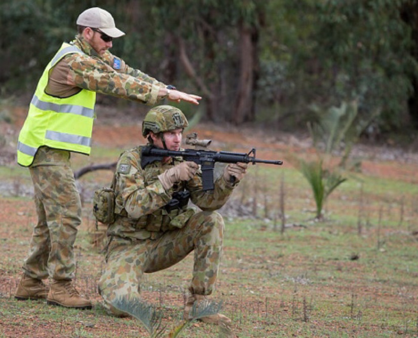
“Dropping bombs, shooting guns and missiles, and employing laser range finders are inherently risky activities which the military manages by conducting rigorous and frequent training exercises. Every day, military units around the globe are conducting training exercises to prepare for actual combat operations.
During combat operations, military personnel will be required to employ direct and indirect-fire weapons systems such as machine guns, field artillery, and mortars. Air forces will be dropping bombs or shooting guns, rockets and missiles from planes and helicopters as well. To perform these key functions effectively, the military needs to train realistically and often to maintain proficiency and combat readiness.” – Dave Barile, a Battelle National Security Project Manager, COLUMBUS, Ohio, Jan. 14, 2015.
I came to Defence in 1998 and worked as an intelligence analyst for 13 years. In 2011 I moved to the Infrastructure Division to fill a position as Assistant Director Spatial Information. When I got there I ran across a fellow ex-analyst and asked him what it was like. He said “Andrew, prepare yourself, it is incredibly backward.”
What I found was an organisation that was 20 years or more behind local government in using modern geospatial capability, software and information for asset management. What capped it off for me was watching range safety inspectors using 1:25k maps, sheets of cellophane, protractors, scale rulers, pens and pencils to study and assess range safety traces. It was like I was taken back 35 years, watching command post personnel plot mortar fire. Range policy personnel did not have it any better, cellophane and a 1:25k map to try to locate and fit a possible new range in at Holsworthy. Military personnel were doing the same if they had to provide safety traces for training.
In an age of laser guided bombs, virtual reality software and a diversity of lethal modern weapons, there has to be a better way to assist them with their tasks. A process that was faster, more accurate, more convenient, have a lesser chance of human error and which would allow users to deliver a better safety product.
So, I started asking questions, analysing, experimenting and searching. I looked at Defence’s Training Area Safety & Management System (TASMIS) and its functionality. I worked briefly at developing something in-house. The journey led me to a product that the U.S. firm Geographic Information Services Inc (GISinc) produce in conjunction with the U.S. Marine Corps (USMC) – the Range Manager Toolkit (RMTK).
Here was a purpose built solution that addressed the issues – and more, and Australia does not have an equivalent.
The RMTK
“RMTK is a framework of interrelated (geospatial software) tools that assist the Range Manager and Range Control staff in operating a safer and more efficient range complex.” – RMTK handbook, USMC Range and Training Area Management Division.
RMTK tools of interest to Australia:
1. Surface Danger Zones and Foreign Surface Danger Zones
(to include laser surface danger zones)
2. On-range ammunition storage potential explosive radii
3. Range development and planning
4. Range design
5. Range-related noise
6. Explosive training range danger zones
7. Range clearance
8. Range management data visualisation (3D)
9. Weapon danger zones (already being obtained by the RAAF for the F35)
10. Probabilistic surface danger zones
11. Training event visualisation
One of the primary RMTK tools, and that which addressed my initial criteria, is that for Surface Danger Zones (SDZ).
“SDZs define the ground and airspace within the training complex (to include associated safety areas) for vertical and lateral containment of projectiles, fragments, debris and components resulting from the firing, launching or detonation of weapon systems to include explosives and demolitions.”
“The RMTK SDZ (tool) allows users to develop, store, modify, analyse, display and print individual and composite multi-weapon surface danger zones.” – RMTK handbook.
Understanding, defining and plotting SDZs appropriate to weapon, ammunition and exercise type is critical to safe live fire training.
It is important to know that the RMTK wasn’t just developed for U.S. armed forces, but was also developed for multi-national adoption. As well as the U.S. the RMTK is used by five eye partners Canada and the U.K. and is currently being assessed for adoption by New Zealand. The RMTK is for multi-national use, and the Australian Defence Force is already an active partner in its development.
Where the SDZ is largely U.S. centric, its child, the Foreign Surface Danger Zones (FSDZ) tool contains danger zones as determined by numerous foreign (to U.S.) armed forces’ safety policies, including Australia. Australian Defence personnel, engineers responsible for ballistics and range safety policy contribute to the development of FSDZ. The FSDZ already contains Australian Surface Danger Zones – and it’s ready to use off-the-shelf, now – and – it is also FREE (!).
The RMTK can be used by:
• Military personnel planning live fire exercises
• Range managers
• Range designers and developers
• Range safety officers
• Range safety inspectors, and
• Range policy staff.
The RMTK is
• Fast (FSDZ – enter firing point, target, weapon and ammunition – done)
• Convenient
• Portable (it can operate on stand-alone laptops)
• Accurate
• Informative
• Simple (there is a basic browser version)
• Consistent
• Integrated
• Unclassified
• Versatile (additional geospatial data can easily be added)
• Deployable (it can be used here and overseas by Australian and foreign forces)
• Fully developed, mature and supported
• Multi-national (data can be shared)
• Free (mostly)
• Available to Australia for unrestricted use
• Available now.
The USMC RMTK capability would bring Australian Defence range safety forward into a dynamic electronic geospatial environment and into the 21st century.
About the author
Andrew Wallace is an Assistant Director Spatial Information in the Estate Planning Branch, Infrastructure Division, E&IG. He spent 13 years as an intelligence/imagery analyst with DIGO/AGO.
Images courtesy of GISinc and the Australian Department of Defence.


